Line 6 of the Paris Metro
Version:Line 6 is famous for its elevated sections, especially near the Eiffel Tower. It offers one of the most impressive views of the tower and other monuments as the train travels over the Bir-Hakeim viaduct.
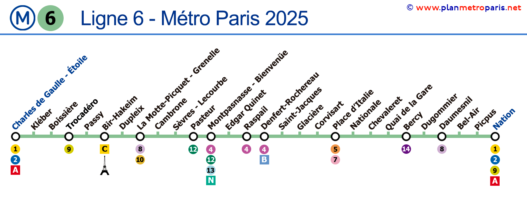
Map of Line 6
See the stations on the map below ():
→ Click to enlarge ←

General Data
Description of Line 6 of the Paris Metro:
- Opened in various stages, between 1900 and 1909.
- Colour: Dark green.
- Combines underground and elevated sections, known for its spectacular views of the Eiffel Tower and other Paris landmarks.
- With 28 stations.
- Total track length of approximately 13.6 km (8.5 miles), with 6.1 km (3.8 miles) of elevated sections.
Historical and Current Curiosities
Interesting facts about Line 6 of the Paris Metro:
- The line offers exceptional views of the Eiffel Tower, especially when crossing the River Seine between the Passy and Bir-Hakeim stations.
- Nearly half of its route is elevated, allowing enjoyment of the city during the journey.
- A significant part of the line follows the layout of the ancient Fermiers généraux walls, adding a historical aspect to the route.
- It was one of the first lines in Paris to be equipped with rubber-tired trains, in 1974, to reduce noise on the elevated sections.
- The Bir-Hakeim station is especially famous for its panoramic view of the Eiffel Tower, being a favourite spot for tourists and photographers.
If you want to see all the lines, we invite you to view the complete Paris Metro map or if you prefer, you can check the maps line by line we have made.
-List of Stations on Line 6
Here is the list of all the stations on the Jubilee line, which in total has 28 stops. If you click on the line icons, you will see information about that line and its transfers.
Route: Charles de Gaulle/Étoile - Nation
Paris Metro Map | Timetables | Fares | All Metro Lines