Line 1 of the Paris Metro
Version: 2025Line 1 was inaugurated in 1900 for the Paris Universal Exhibition. It was the first line to be constructed and one of the first in the world. It was also the first line in Paris to be fully automated, eliminating the need for drivers in 2012.
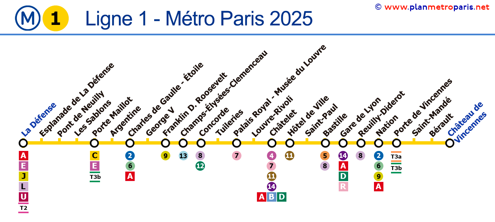
Map of Line 1
In the map below you will find all the stations of Line 1, the information has been updated in 2025.

General Information
Description of Line 1 of the Paris Metro:
- Inaugurated in July 1900 for the Paris Universal Exhibition.
- Colour: Yellow.
- Fully underground with aerial sections to cross the Seine.
- 25 stations.
- Total track length of 16.5 km (10.3 miles).
Historical and Current Curiosities
Interesting facts about Line 1 of the Paris Metro:
- It was the first line of the Paris Metro to be inaugurated, entering service on July 19, 1900.
- It is the busiest line in the metro network that does not belong to the RER, with 181.2 million travellers in 2017.
- It was the first line in the network to be converted from manual to fully automated operation between 2007 and 2011.
- Several MP 89 trains were stored on Line 1 until a new garage for Line 4 was opened in February 2013.
- The line is currently undergoing an extension towards Val de Fontenay to connect with the future Line 15 of the metro, RER A, RER E, and an extension of Tram 1.
List of Stations on Line 1
Route: La Défense/Grande Arche - Château de Vincennes
Here is the list of all the stations on Line 1, which in total has 25 stops. If you click on a metro line icon, you will see information about that line and its transfers.
Paris Metro Map | Timetables | Fares | All Metro Lines