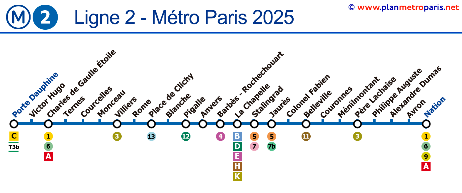
Map of Line 2 of the Paris Metro
Version: January 2025Known for its stunning city views, Line 2 of the Paris Metro runs above ground on the Line 2 viaduct, offering a panoramic view of iconic places like Montmartre and the famous Moulin Rouge cabaret.
Line 2
See the stations on the map below:

General Information
Description of Line 2 of the Paris Metro:
- Inaugurated in 1900, originally as a circular line.
- Colour: Blue.
- Combines underground and elevated sections, being elevated from Barbès-Rochechouart to Jaurès.
- It has 13 elevated stations and 12 underground stations, totalling 25 stations.
- Track length of approximately 12.4 km (7.7 miles).
Historical and Current Curiosities
Interesting facts about Line 2 of the Paris Metro:
- It is almost entirely situated on the old Paris customs wall and makes a semicircle on the north of the city.
- It is the ninth busiest metro line in the world, with 105.2 million travellers in 2017.
- More than 2 km of the line were built on an elevated viaduct with four aerial stations.
- In 1903, it was the site of the worst incident in the history of the Paris Metro, the Couronnes fire.
- The elevated stations between Barbès - Rochechouart and Jaurès offer views of Paris, and their architecture recalls the style of Gustave Eiffel.
- The Porte Dauphine station is notable for having one of the two art nouveau style entrances designed by Hector Guimard.
If you want to see all the lines, we invite you to view the complete Paris Metro map or if you prefer, you can consult the line-by-line maps we have made.
List of Stations on Line 2
Here is the list of stations on Line 2. If you click on the line icons, you will see information about that line and its transfers.
Route: Porte Dauphine - Nation
Paris Metro Map | Timetables | Fares | All Metro Lines